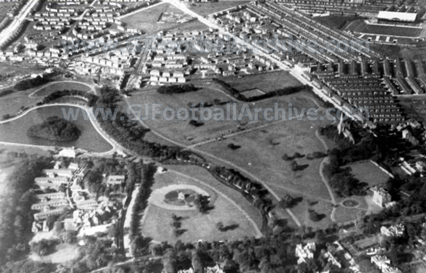
For day 48 of my posts counting down to the centenary of Maine Road’s opening game I’ve posted this aerial photo from 1925. People often talk about Maine Road being surrounded by tightly packed housing and it was but there was also quite a bit of green too, as this image shows.
Additional housing was erected in the area towards the top in the years that followed. In fact I think the entire estate was being built at the time this photo was being taken.
Maine Road is of course in the top right of this image. Notice also the sports ground at the top right corner of Platt Fields Park. This had a number of uses over the years and I think it was a police ground at this time. It later became City’s Platt Lane training ground of course.
If you’d like to read more on the history of Maine Road, take a look at Farewell To Maine Road, which can be downloaded from this page:
If you enjoy all the free material on my website and would like to support my research and keep this website going (but don’t want to subscribe) then why not make a one-time donation (or buy me a coffee). All support for my research is valued and welcome. It allows me to keep some free material available for all. Thanks.
Choose an amount
Or enter a custom amount
Your contribution is appreciated.
Donate