
Day 58 of my posts counting down to the centenary of Maine Road’s opening game is an aerial photo of the ground from about 1973. Unusually this image looks towards the ground from behind the North Stand (from the city centre direction looking south) and shows the streets that would soon disappear as part of the area’s housing developments.
I’ve highlighted what became recognised as MCFC property with blue lines – that’s the stadium site plus the Platt Lane training complex, which became City’s during the 1970s.
The two areas marked in yellow on either side of Lloyd Street South were redeveloped into Walks and Closes named after former City players. Many of these new Walks & Closes still exist, although some have been remodelled and the names of some, for example the one named after Frank Swift, have disappeared altogether.
The are marked in pink between the player streets and the stadium became the Claremont Road School playing fields which, on match day, provided extra car parking for supporters.

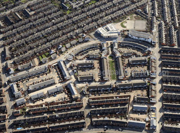
It’s worth comparing that 1970s image with this one from recent years, showing the housing and school now built on Maine Road.
And compare both to this 1940s image of the Maine Road site too:

This 1971 aerial image shows the stadium from another angle, looking west.

If you’d like to read more on the history of Maine Road, take a look at Farewell To Maine Road, which can be downloaded from this page:
If you enjoy all the free material on my website and would like to support my research and keep this website going (but don’t want to subscribe) then why not make a one-time donation (or buy me a coffee). All support for my research is valued and welcome. It allows me to keep some free material available for all. Thanks.
Choose an amount
Or enter a custom amount
Your contribution is appreciated.
Donate