
I’m not certain how many match going fans realise how close the site of Manchester City’s is to the site of Manchester United’s old Bank Street ground. The Reds moved back in 1910 to Old Trafford and the site is now the home of the BMX indoor centre. You can see the old ground on the right of the old map below (c.1910), while City’s current Etihad Stadium can be seen in the middle of the newer map. A few other things to look out for:
- Rowsley Street still exists (this is the road that cars turn on to just before the main access road which heads towards the main entrance of the Etihad.
- Philips Park, the river, the railway, canal and main roads remain.
- Part of the Electricity works complex still survives, near the Velodrome. As does part of the gas works, north west of the Etihad.
- Present day Alan Turing Way is a slightly modified Mill Street/Grey Mare Lane. Forge Lane is now within the car parking area, east of the stadium, but the Forge Lane bridge over the canal still exists between the Co-op Live arena and the car parks (to the east of Joe Mercer Way’s more modern bridge).
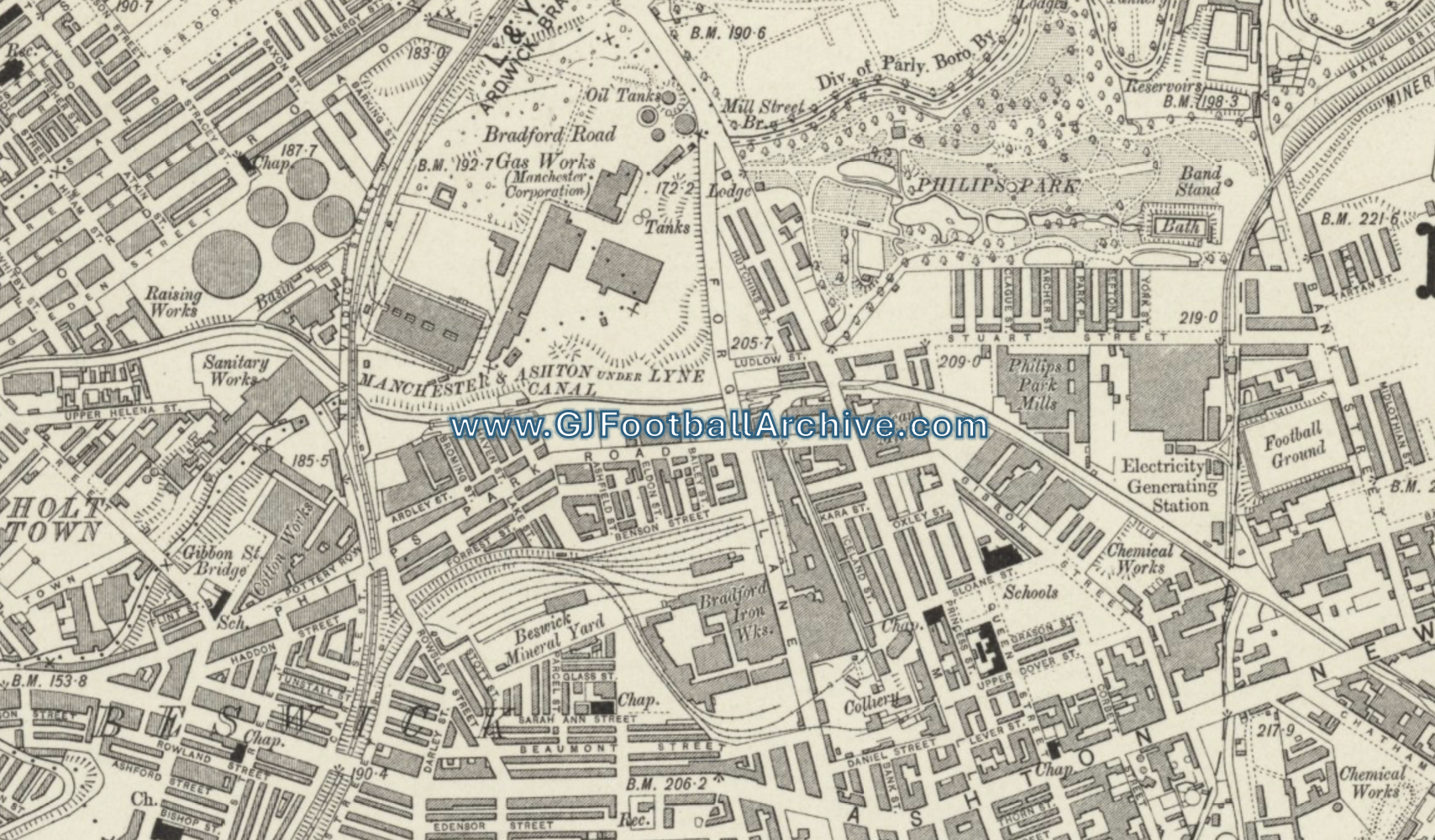
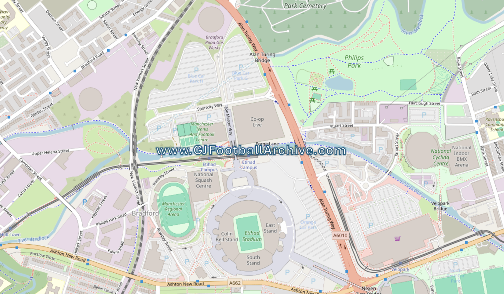
Move the arrows in the photo to compare maps.
